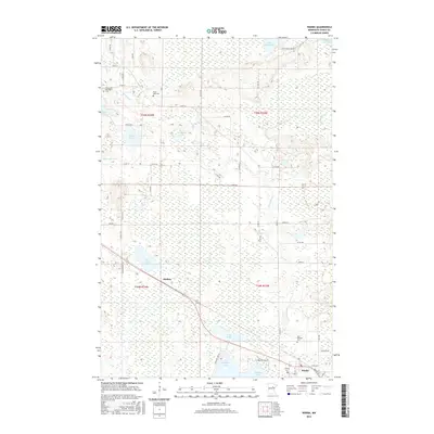
2016 Map of Warba
USGS Topo · Published 2016About this map
The Swan River meanders south through this Itasca County landscape, anchoring a region defined by extensive wetlands and glacial lakes. The settlement of Warba sits at the junction of local transit routes in the southeast, serving as a focal point for the surrounding rural townships. Further northwest, the smaller locality of Philbin appears along the roadway, marking the transition toward the densely wooded areas surrounding Rice Lake and Shallow Lake.
Find a feature on this map
55 named features on this map. Tap any name to fly to it.
Don’t see what you’re looking for? This feature index may not catch every label — zoom into the map to look around manually.
Map Details
Editions of this 2016 Warba Map
This is the sole edition of this map. No revisions or reprints were ever made.
Other maps of this area

1920 · Trout Lake
USGS Topo · 1:62,500

1952 · Calumet
USGS Topo · 1:24,000

1952 · Pengilly
USGS Topo · 1:24,000

1952 · Bovey
USGS Topo · 1:24,000

1954 · Hibbing
USGS Topo · 1:250,000

1957 · Hibbing
USGS Topo · 1:250,000

1958 · Hibbing
USGS Topo · 1:250,000

1964 · Hibbing
USGS Topo · 1:250,000

1969 · La Prairie
USGS Topo · 1:24,000
1969 · Goodland
USGS Topo · 1:24,000