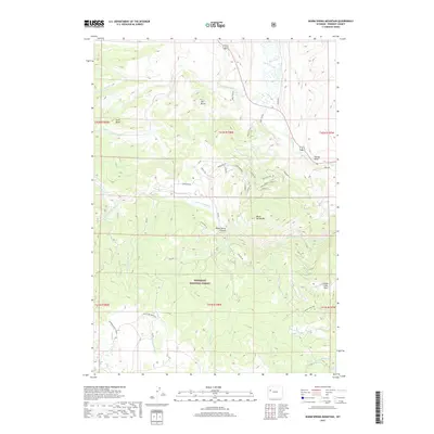
2017 Map of Warm Spring Mountain
USGS Topo · Published 2017About this map
The Wind River flows through the northeast corner of this high-elevation landscape, where the waters of Du Noir Creek and Bench Cr contribute to its course. Dominated by the protected expanse of the Shoshone National Forest, the terrain is defined by dramatic geologic features including Warm Spring Mtn, Hat Butte, and Sand Butte. The map reveals a complex network of forest roads and historic routes, such as Union Pass Rd and Wind River Dr, which provide access to the rugged interior near Warm Spring Canyon. Recreation is central to this area of Fremont County, as evidenced by the presence of Geyser Creek Park and specialized pathways like the Snowshoe Atv Trail. These drainage systems, including Kitten Cr and Wildcat Cr, create a deeply dissected topography that has shaped human movement and settlement patterns in this Wyoming wilderness.
Find a feature on this map
53 named features on this map. Tap any name to fly to it.
Don’t see what you’re looking for? This feature index may not catch every label — zoom into the map to look around manually.
Map Details
Editions of this 2017 Warm Spring Mountain Map
This is the sole edition of this map. No revisions or reprints were ever made.
Other maps of this area

1905 · Younts Peak
USGS Topo · 1:125,000

1907 · Younts Peak
USGS Topo · 1:125,000

1909 · Fremont Peak
USGS Topo · 1:125,000

1955 · Thermopolis
USGS Topo · 1:250,000

1956 · Dubois
USGS Topo · 1:24,000

1956 · Esmond Park
USGS Topo · 1:24,000

1956 · Ramshorn Peak
USGS Topo · 1:24,000

1956 · Warm Spring Mountain
USGS Topo · 1:24,000

1956 · Fish Lake
USGS Topo · 1:24,000

1956 · Kisinger Lakes
USGS Topo · 1:24,000