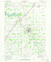
1969 Map of Warren
USGS Topo · Published 1971About this map
Warren serves as the focal point for this 1969 field survey, situated at the confluence of the Salamonie River and several drainage routes including Detamore Ditch. The landscape reflects a mix of small-town infrastructure and rural extraction, characterized by numerous Oil Wells and a Gassing Sta dotting the countryside. Higher education and community life are represented by the Jr High Sch and Tower Park, while the local economy is supported by the Norfolk and Western rail line.
Find a feature on this map
57 named features on this map. Tap any name to fly to it.
Don’t see what you’re looking for? This feature index may not catch every label — zoom into the map to look around manually.
Map Details
Editions of this 1969 Warren Map
2 editions found
Other maps of this area

1950 · Andrews
USGS Topo · 1:24,000

1950 · Warren
USGS Topo · 1:24,000

1950 · Mount Etna
USGS Topo · 1:24,000

1951 · Mount Etna
USGS Topo · 1:24,000

1951 · Andrews
USGS Topo · 1:24,000

1952 · Warren
USGS Topo · 1:24,000

1952 · Majenica
USGS Topo · 1:24,000

1953 · Muncie
USGS Topo · 1:250,000

1955 · Markle
USGS Topo · 1:24,000

1956 · Muncie
USGS Topo · 1:250,000