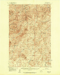
1959 Map of Warrick
USGS Topo · Published 1961About this map
The Bearpaw Mountains dominate this 1959 survey of North-Central Montana, where high-altitude peaks and deep coulees define the landscape across the borders of Hill, Chouteau, and Blaine counties. Much of the northern terrain is occupied by the Rocky Boy Indian Reservation, featuring prominent summits like Baldy Mtn and Moses Mtn. A scattering of human enterprise is visible at the Silver King Mine and the Parker Sch in the northwest.
Find a feature on this map
56 named features on this map. Tap any name to fly to it.
Don’t see what you’re looking for? This feature index may not catch every label — zoom into the map to look around manually.
Map Details
Editions of this 1959 Warrick Map
3 editions found
Other maps of this area

1953 · Havre
USGS Topo · 1:250,000

1954 · Lewistown
USGS Topo · 1:250,000

1956 · Maddux
USGS Topo · 1:62,500

1956 · Lloyd
USGS Topo · 1:62,500

1957 · Havre
USGS Topo · 1:250,000

1958 · Havre
USGS Topo · 1:250,000

1959 · Lewistown
USGS Topo · 1:250,000

1959 · Warrick
USGS Topo · 1:62,500

1959 · Laredo
USGS Topo · 1:62,500

1959 · Centennial Mountain
USGS Topo · 1:62,500