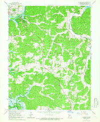
1964 Map of Warsaw East
USGS Topo · Published 1966About this map
Warsaw anchors the northwest corner of this Benton County landscape, situated where the Osage River meets the expanding waters of the Lake of the Ozarks. This 1964 field-checked survey captures a transitional moment for the region, specifically marking areas in blue hatching destined to be submerged by the impending Kaysinger-Bluff Reservoir. The map documents a predominantly rural fabric of small communities like Old Fredonia, Dell, and Majorville, many of which were historically defined by their proximity to the river and its numerous tributaries such as Turkey Creek and Whig Creek. Genealogists will find significant value in the documentation of family-named landmarks and rural institutions, including Post Oak Cem, Evening Shade Ch, and the R 6 Sch. The topography reveals a complex network of hollows and ridges, from Scott Hollow to the high ground of Kaysinger Bluff, showing the original drainage patterns before the full inundation of the reservoir changed the shoreline forever.
Find a feature on this map
47 named features on this map. Tap any name to fly to it.
Don’t see what you’re looking for? This feature index may not catch every label — zoom into the map to look around manually.
Map Details
Editions of this 1964 Warsaw East Map
3 editions found
Other maps of this area

1887 · Warsaw
USGS Topo · 1:125,000

1894 · Warsaw
USGS Topo · 1:125,000

1935 · Edwards
USGS Topo · 1:24,000

1935 · Dell
USGS Topo · 1:24,000

1936 · Shawnee Bend
USGS Topo · 1:24,000

1936 · Lakeview Heights
USGS Topo · 1:24,000

1936 · Schuyler
USGS Topo · 1:24,000

1945 · Fristoe
USGS Topo · 1:62,500

1947 · Jefferson City
USGS Topo · 1:250,000

1954 · Jefferson City
USGS Topo · 1:250,000