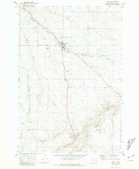
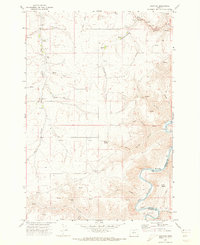
1971 Map of Wasco
USGS Topo · Published 1981About this map
The wheat-growing plateau of Sherman County is centered around Wasco in this 1970s topographic record. The landscape is defined by deep coulees and hollows, including Spanish Hollow and China Hollow, which cut through the high ground. The town serves as a regional hub for the agricultural economy, evidenced by the large Grain Elevator and numerous Storage Bins clustered near the Old Railroad Grade. To the south, the settlement of DeMoss Springs is noted with its own Picnic Area and Substation, marking a distinct pocket of development along the highway route.
Find a feature on this map
35 named features on this map. Tap any name to fly to it.
Don’t see what you’re looking for? This feature index may not catch every label — zoom into the map to look around manually.
Map Details
Editions of this 1971 Wasco Map
3 editions found
Other maps of this area

1953 · The Dalles
USGS Topo · 1:250,000

1956 · The Dalles
USGS Topo · 1:250,000

1957 · The Dalles
USGS Topo · 1:250,000

1957 · Wasco
USGS Topo · 1:62,500

1957 · Wishram
USGS Topo · 1:62,500

1962 · Erskine
USGS Topo · 1:24,000

1971 · Moro
USGS Topo · 1:24,000

1971 · Quinton
USGS Topo · 1:24,000
1971 · Klondike
USGS Topo · 1:24,000
1971 · Harmony
USGS Topo · 1:24,000