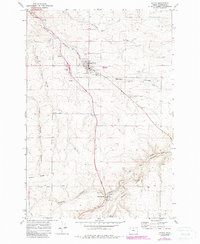
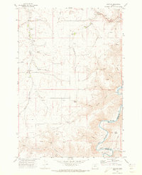
1971 Map of Wasco
USGS Topo · Published 1987About this map
Wasco serves as the focal point of this Sherman County landscape, shown here during a period of infrastructure revision in the early 1970s and 1980s. The town's economy is clearly tied to the surrounding wheat country, evidenced by the Grain Elevator and numerous Storage Bins situated along the industrial corridor. The transportation history of the region is etched into the terrain by the presence of an Old RR Grade and the Old Railroad Grade winding through Spanish Hollow, marking the paths of former rail lines that once moved agricultural goods through these deep canyons.
Find a feature on this map
35 named features on this map. Tap any name to fly to it.
Don’t see what you’re looking for? This feature index may not catch every label — zoom into the map to look around manually.
Map Details
Editions of this 1971 Wasco Map
3 editions found
Other maps of this area

1953 · The Dalles
USGS Topo · 1:250,000

1956 · The Dalles
USGS Topo · 1:250,000

1957 · The Dalles
USGS Topo · 1:250,000

1957 · Wasco
USGS Topo · 1:62,500

1957 · Wishram
USGS Topo · 1:62,500

1962 · Erskine
USGS Topo · 1:24,000

1971 · Moro
USGS Topo · 1:24,000

1971 · Quinton
USGS Topo · 1:24,000
1971 · Klondike
USGS Topo · 1:24,000
1971 · Harmony
USGS Topo · 1:24,000