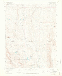
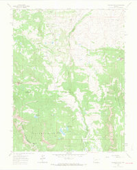
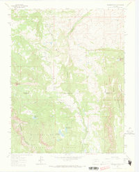
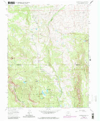
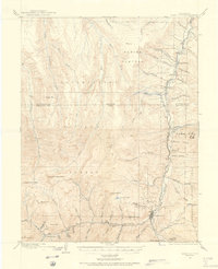
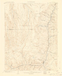
1963 Map of Washboard Rock
USGS Topo · Published 1966About this map
The Cimarron River carves through this high-altitude landscape of southwestern Colorado, defining the eastern reach of the Uncompahgre National Forest. The 1963 survey captures a high-country terrain managed for water and recreation, marked by the presence of the Cimarron Canal and several high-elevation basins. Remote outposts like the Big Cimarron Ranch and the Big Cimarron Campground serve as human focal points in a region otherwise dominated by the sharp relief of Cimarron Ridge and the broad expanses of High Mesa.
Find a feature on this map
32 named features on this map. Tap any name to fly to it.
Don’t see what you’re looking for? This feature index may not catch every label — zoom into the map to look around manually.
Map Details
Editions of this 1963 Washboard Rock Map
5 editions found

Other maps of this area

1902 · Ouray
USGS Topo · 1:62,500
1903 · Lake City
USGS Topo · 1:62,500

1904 · Ouray
USGS Topo · 1:62,500
1905 · Lake City
USGS Topo · 1:62,500

1908 · Uncompahgre
USGS Topo · 1:125,000

1909 · Montrose
USGS Topo · 1:125,000

1911 · Uncompahgre
USGS Topo · 1:125,000

1911 · Montrose
USGS Topo · 1:125,000

1956 · Curecanti Needle
USGS Topo · 1:24,000

1956 · Cimarron
USGS Topo · 1:24,000