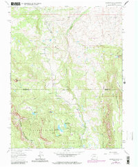
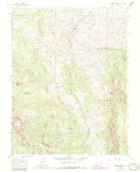
1963 Map of Washboard Rock
USGS Topo · Published 1984About this map
Uncompahgre National Forest and the Cimarron State Wildlife Area dominate this high-altitude landscape along the border of Montrose and Gunnison counties. The terrain is defined by dramatic vertical relief, from the sheer face of Washboard Rock and the heights of Cimarron Ridge to the broad expanses of High Mesa and Horse Mesa. The Cimarron River carves through the central valley, supported by a complex network of alpine drainage including Veo Creek, Burdick Creek, and Coal Creek.
Find a feature on this map
34 named features on this map. Tap any name to fly to it.
Don’t see what you’re looking for? This feature index may not catch every label — zoom into the map to look around manually.
Map Details
Editions of this 1963 Washboard Rock Map
5 editions found
Other maps of this area

1902 · Ouray
USGS Topo · 1:62,500

1903 · Lake City
USGS Topo · 1:62,500

1904 · Ouray
USGS Topo · 1:62,500

1905 · Lake City
USGS Topo · 1:62,500

1908 · Uncompahgre
USGS Topo · 1:125,000

1909 · Montrose
USGS Topo · 1:125,000

1911 · Uncompahgre
USGS Topo · 1:125,000

1911 · Montrose
USGS Topo · 1:125,000

1956 · Curecanti Needle
USGS Topo · 1:24,000

1956 · Cimarron
USGS Topo · 1:24,000