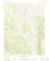
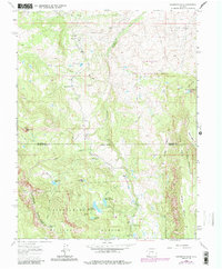
1963 Map of Washboard Rock
USGS Topo · Published 1984About this map
Cimarron Ridge and the high plateaus of Horse Mesa define this mid-century landscape on the border of Montrose and Gunnison Counties. The Cimarron River winds through the central valley, supported by an irrigation network that includes the Fish Creek Reservoir No 1 and Fish Creek Reservoir No 2. This area is characterized by seasonal livestock grazing and water management, evidenced by features like Moore Pasture Creek and the remote Big Cimarron Ranch.
Find a feature on this map
31 named features on this map. Tap any name to fly to it.
Don’t see what you’re looking for? This feature index may not catch every label — zoom into the map to look around manually.
Map Details
Editions of this 1963 Washboard Rock Map
5 editions found
Other maps of this area

1902 · Ouray
USGS Topo · 1:62,500

1903 · Lake City
USGS Topo · 1:62,500

1904 · Ouray
USGS Topo · 1:62,500

1905 · Lake City
USGS Topo · 1:62,500

1908 · Uncompahgre
USGS Topo · 1:125,000

1909 · Montrose
USGS Topo · 1:125,000

1911 · Uncompahgre
USGS Topo · 1:125,000

1911 · Montrose
USGS Topo · 1:125,000

1956 · Curecanti Needle
USGS Topo · 1:24,000

1956 · Cimarron
USGS Topo · 1:24,000