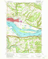
1961 Map of Washougal
USGS Topo · Published 1971About this map
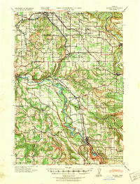
The Columbia River separates Washington and Oregon at this narrow gorge opening, where the industrial centers of Camas and Washougal dominate the northern bank. In the early 1960s, these towns served as vital hubs for the Burlington Northern railroad, while the southern shore in Multnomah County remained defined by the steep bluffs of Crown Point State Park and the winding Columbia River Highway.
Find a feature on this map
48 named features on this map. Tap any name to fly to it.
Don’t see what you’re looking for? This feature index may not catch every label — zoom into the map to look around manually.
Map Details
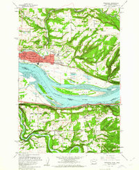
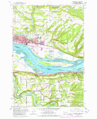
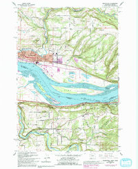
Editions of this 1961 Washougal Map
4 editions found
Other maps of this area

1911 · Boring
USGS Topo · 1:48,000

1914 · Boring
USGS Topo · 1:62,500

1916 · Estacada
USGS Topo · 1:125,000

1918 · Troutdale
USGS Topo · 1:62,500

1934 · Troutdale
USGS Topo · 1:48,000
1940 · Boring
USGS Topo · 1:62,500

1941 · Camas
USGS Topo · 1:62,500

1942 · Camas
USGS Topo · 1:62,500

1948 · Vancouver
USGS Topo · 1:250,000

1950 · Vancouver
USGS Topo · 1:250,000