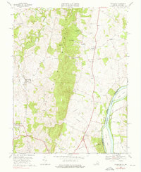
1970 Map of Waterford
USGS Topo · Published 1976About this map
Catoctin Mountain bisects this landscape, creating a dramatic physical divide between the agricultural valleys of northern Loudoun County and the Potomac River corridor. The settlement of Waterford is positioned at the confluence of the North Fork and South Fork of Catoctin Creek, showing the classic compact pattern of an early Piedmont village. To the east, the Potomac River serves as the state boundary with Maryland, accompanied by the historic Chesapeake and Ohio Canal on the opposite bank. The map documents vital crossing points like Whites Ferry, connecting Whites Ferry Road to the Maryland shore. Significant local landmarks include Balls Bluff National Cemetery overlooking the river and the rural crossroads at Clarks Gap and Lucketts. The distribution of country churches, such as Mt Pleasant Ch and Bethel Ch, reflects the area's deep-rooted social and community fabric in the mid-20th century.
Find a feature on this map
35 named features on this map. Tap any name to fly to it.
Don’t see what you’re looking for? This feature index may not catch every label — zoom into the map to look around manually.
Map Details
Editions of this 1970 Waterford Map
4 editions found
Other maps of this area

1884 · Harpers Ferry
USGS Topo · 1:125,000

1891 · Harpers Ferry
USGS Topo · 1:125,000

1893 · Frederick
USGS Topo · 1:125,000

1893 · Harpers Ferry
USGS Topo · 1:125,000

1894 · Frederick
USGS Topo · 1:125,000

1908 · Middletown
USGS Topo · 1:48,000

1908 · Seneca
USGS Topo · 1:62,500

1908 · Ijamsville
USGS Topo · 1:62,500

1909 · Ijamsville
USGS Topo · 1:62,500

1910 · Antietam
USGS Topo · 1:62,500