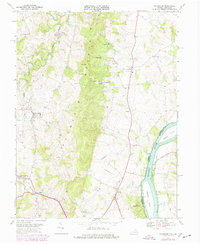
1970 Map of Waterford
USGS Topo · Published 1978About this map
Catoctin Mountain bisects the landscape of Loudoun County, separating the agricultural valleys around Waterford from the Potomac River corridor. This 1970s record illustrates a transitional period in northern Virginia, documenting the rural character of communities like Lucketts and Paeonian Springs before the significant suburban expansion of the late 20th century. Along the river, Mason Island and Harrison Island mark the boundary with Maryland, while the Balls Bluff National Cemetery stands as a significant landmark on the Virginia shore. Local infrastructure is captured through the presence of an Old Railroad Grade near Clarks Gap and several rural sanctuaries, including Mt Pleasant Ch and Bethel Ch. Notable local features such as the Glaydin Sch and the Fairgrounds reflect the civic life of these Piedmont settlements.
Find a feature on this map
34 named features on this map. Tap any name to fly to it.
Don’t see what you’re looking for? This feature index may not catch every label — zoom into the map to look around manually.
Map Details
Editions of this 1970 Waterford Map
4 editions found
Other maps of this area

1884 · Harpers Ferry
USGS Topo · 1:125,000

1891 · Harpers Ferry
USGS Topo · 1:125,000

1893 · Frederick
USGS Topo · 1:125,000

1893 · Harpers Ferry
USGS Topo · 1:125,000

1894 · Frederick
USGS Topo · 1:125,000

1908 · Middletown
USGS Topo · 1:48,000

1908 · Seneca
USGS Topo · 1:62,500

1908 · Ijamsville
USGS Topo · 1:62,500

1909 · Ijamsville
USGS Topo · 1:62,500

1910 · Antietam
USGS Topo · 1:62,500