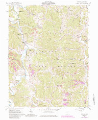
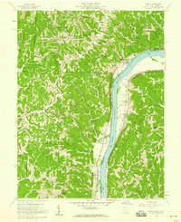
1961 Map of Waterloo
USGS Topo · Published 1985About this map
Symmes Creek carves a winding path through this corner of the Wayne National Forest, defining the settlement patterns of southern Ohio during the mid-20th century. The small communities of Waterloo, Arabia, and Wilgus are concentrated along these valley floors, connected by a network of rural roads such as Flag Springs Road and Campground Road. The uplands, including Hog Back Ridge and Greasy Ridge, reflect a landscape increasingly dominated by resource extraction, evidenced by numerous Strip Mines and several Reclaimed Strip Mines appearing in later revisions.
Find a feature on this map
105 named features on this map. Tap any name to fly to it.
Don’t see what you’re looking for? This feature index may not catch every label — zoom into the map to look around manually.
Map Details
Editions of this 1961 Waterloo Map
4 editions found
Other maps of this area

1898 · Ironton
USGS Topo · 1:62,500

1900 · Ironton
USGS Topo · 1:62,500

1906 · Bidwell
USGS Topo · 1:62,500

1906 · Athalia
USGS Topo · 1:62,500

1908 · Bidwell
USGS Topo · 1:62,500

1908 · Athalia
USGS Topo · 1:62,500

1912 · Oak Hill
USGS Topo · 1:62,500

1957 · Huntington
USGS Topo · 1:250,000
1958 · Athalia
USGS Topo · 1:24,000

1960 · Huntington
USGS Topo · 1:250,000