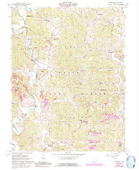
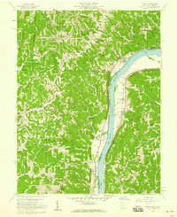
1961 Map of Waterloo
USGS Topo · Published 1992About this map
Symmes Ridge and Greasy Ridge define the complex, dissected landscape of southern Ohio shown in this 1960s study, where the Wayne National Forest encompasses much of the terrain. The map documents a rural economy in transition, marked by numerous Strip Mines and several Reclaimed Strip Mines scattered among the hollows. Small communities like Waterloo and Arabia serve as focal points along Symmes Creek, while the ridges are dotted with family-named cemeteries such as Saunders Cem, Jackson Cem, and Haskins Cem. Local spiritual life is anchored by country churches like Flag Spring Ch and Palestine Ch, providing a detailed look at the social geography of Lawrence and Gallia Counties. The extensive network of secondary routes, including Webster Rd and Mt Zion Road, connects these isolated upland settlements and family farmsteads.
Find a feature on this map
72 named features on this map. Tap any name to fly to it.
Don’t see what you’re looking for? This feature index may not catch every label — zoom into the map to look around manually.
Map Details
Editions of this 1961 Waterloo Map
4 editions found
Other maps of this area

1898 · Ironton
USGS Topo · 1:62,500

1900 · Ironton
USGS Topo · 1:62,500

1906 · Bidwell
USGS Topo · 1:62,500

1906 · Athalia
USGS Topo · 1:62,500

1908 · Bidwell
USGS Topo · 1:62,500

1908 · Athalia
USGS Topo · 1:62,500

1912 · Oak Hill
USGS Topo · 1:62,500

1957 · Huntington
USGS Topo · 1:250,000
1958 · Athalia
USGS Topo · 1:24,000

1960 · Huntington
USGS Topo · 1:250,000