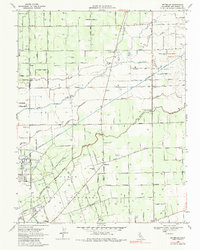
1968 Map of Waterloo
USGS Topo · Published 1980About this map
Agricultural irrigation and transit corridors dominate this San Joaquin Valley landscape east of the Lodi corp bdy. The intricate drainage network of the Mokelumne River and Calaveras River is supplemented by the massive Mokelumne Aqueduct, which cuts diagonally across the terrain toward the south. Small rural communities like Waterloo and Kettleman serve as hubs for a region defined by family-named roads and specialized infrastructure, including the Stockton Terminal and Eastern railroad. Genealogists and local historians can trace the distribution of early educational sites, from the Harmony Grove Sch in the north to the Waterloo Sch near the center. The map also preserves the site of the Jack Tone Homestead Historical Marker, signaling the era of early pioneer settlement and the long-standing agricultural importance of this fertile reach of Central California.
Find a feature on this map
89 named features on this map. Tap any name to fly to it.
Don’t see what you’re looking for? This feature index may not catch every label — zoom into the map to look around manually.
Map Details
Editions of this 1968 Waterloo Map
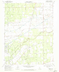
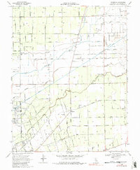
3 editions found
Other maps of this area

1894 · Lodi
USGS Topo · 1:125,000

1908 · Waterloo
USGS Topo · 1:31,680

1908 · Linden
USGS Topo · 1:31,680

1908 · Lockeford
USGS Topo · 1:31,680

1909 · Clements
USGS Topo · 1:31,680

1910 · Castle
USGS Topo · 1:31,680

1910 · Woodbridge
USGS Topo · 1:31,680

1913 · Stockton
USGS Topo · 1:31,680

1914 · Burnham
USGS Topo · 1:31,680

1915 · Peters
USGS Topo · 1:31,680