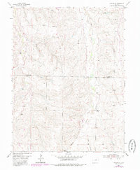
1955 Map of Watkins SE
USGS Topo · Published 1985About this map
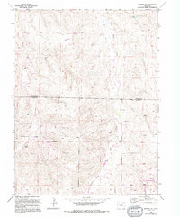
Box Elder Creek and its tributaries carve a network of drainage channels across the high plains of Eastern Colorado, as documented in this mid-century topographic survey. The landscape is defined by the transition across the Arapahoe Co Elbert Co boundary, where the terrain rises from the Coal Creek basin in the west toward the higher ridges in the southeast. Evidence of early rural infrastructure is sparse but significant, including the Schley Sch and an Observation Tower situated on a high point overlooking the rolling prairie.
Find a feature on this map
7 named features on this map. Tap any name to fly to it.
Don’t see what you’re looking for? This feature index may not catch every label — zoom into the map to look around manually.
Map Details
Editions of this 1955 Watkins SE Map
6 editions found

Other maps of this area

1890 · East Denver
USGS Topo · 1:125,000

1894 · Castle Rock
USGS Topo · 1:125,000

1913 · Castle Rock
USGS Topo · 1:125,000

1939 · Coal Creek
USGS Topo · 1:24,000

1939 · Elizabeth
USGS Topo · 1:62,500

1940 · Piney Creek
USGS Topo · 1:24,000

1942 · Piney Creek
USGS Topo · 1:31,680

1942 · Coal Creek
USGS Topo · 1:31,680

1945 · Elizabeth
USGS Topo · 1:62,500

1953 · Denver
USGS Topo · 1:250,000