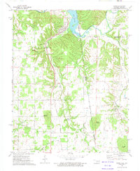
1972 Map of Watts
USGS Topo · Published 1974About this map
Kansas City Southern rails cut a direct path through the heart of the Arkansas-Oklahoma borderlands in the early 1970s, anchoring the small settlements of Watts and Westville. The landscape is defined by the winding course of the Illinois River and the sprawling waters of Lake Frances, where the river crosses the state line. Topographic elevations rise toward Mission Mountain and Bates Mountain, overlooking a terrain dotted with rural spiritual and community centers such as Colony Community Ch and Nicodemus Community Ch. Local history is preserved in several family and community burial grounds, including Sixkiller Cem and Watts Cem, which mark the generational ties of this border region. The presence of a Gravel Pit and various springs like Peacheater Creek suggest a landscape shaped by both small-scale industry and the natural drainage of the Ozark foothills.
Find a feature on this map
35 named features on this map. Tap any name to fly to it.
Don’t see what you’re looking for? This feature index may not catch every label — zoom into the map to look around manually.
Map Details
Editions of this 1972 Watts Map
2 editions found
Other maps of this area

1898 · Tahlequah
USGS Topo · 1:125,000

1898 · Winslow
USGS Topo · 1:125,000

1899 · Fayetteville
USGS Topo · 1:125,000

1899 · Siloam Springs
USGS Topo · 1:125,000

1901 · Winslow
USGS Topo · 1:125,000

1901 · Fayetteville
USGS Topo · 1:125,000

1901 · Tahlequah
USGS Topo · 1:125,000

1903 · Siloam Springs
USGS Topo · 1:125,000

1904 · Siloam Springs
USGS Topo · 1:125,000

1904 · Fayetteville
USGS Topo · 1:125,000