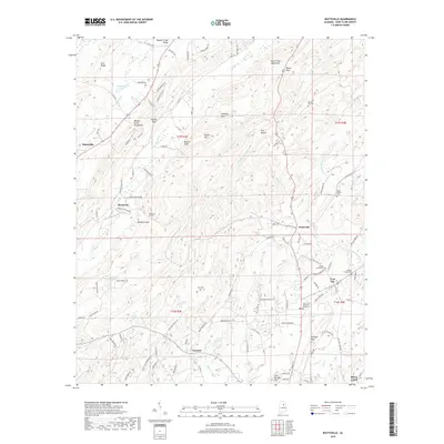
2018 Map of Wattsville
USGS Topo · Published 2018About this map
Shoal Creek Mountains and the Beaver Creek Mountains define the north-south ridges of St. Clair County, creating a series of narrow valleys where agriculture and small settlements take root. This 2018 survey reveals a landscape shaped by both its geology and its transportation infrastructure, most notably where the Hardwick Tunnel pierces through Backbone Mtn near the community of Hardwick. The map documents a cluster of traditional burial sites and church grounds, including Popes Chapel Cem and Harkeys Chapel Cem, which anchor the local history of communities like Coal City and Wattsville. Water features such as Broken Arrow Cr and Beaver Creek wind through the lowlands, while landmarks like Chimney Rock and Bowlin Bluff stand as prominent markers along the ridgelines near Watson Gap.
Find a feature on this map
116 named features on this map. Tap any name to fly to it.
Don’t see what you’re looking for? This feature index may not catch every label — zoom into the map to look around manually.
Map Details
Editions of this 2018 Wattsville Map
This is the sole edition of this map. No revisions or reprints were ever made.
Other maps of this area

1889 · Springville
USGS Topo · 1:125,000

1892 · Springville
USGS Topo · 1:125,000

1947 · Cox Gap
USGS Topo · 1:24,000

1947 · Ragland
USGS Topo · 1:62,500

1947 · Ragland
USGS Topo · 1:24,000

1947 · Riverside
USGS Topo · 1:24,000

1947 · Steele
USGS Topo · 1:62,500

1953 · Birmingham
USGS Topo · 1:250,000

1956 · Birmingham
USGS Topo · 1:250,000

1957 · Birmingham
USGS Topo · 1:250,000