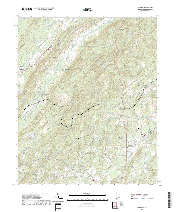
2024 Map of Wattsville
USGS Topo · Published 2024About this map
Backbone Mountain anchors the center of this landscape, dividing the waters of Shoal Creek and Beaver Creek to the northwest from the network of branches and lakes to the southeast. In the western reaches, Odenville marks a point of expansion near Pine Ridge, while the eastern terrain is defined by the ridge lines of Beaver Creek Mountains and the distinct formation at Moon Rock. The settlement pattern follows the valley floors, with Wattsville and Coal City situated among a complex of small waterways like Broken Arrow Creek and Leather Creek. Genealogists will find a significant distribution of local burial sites, from the Popes Chapel Methodist Church Cem to the smaller Karr Cem and Spring Hill Cem, reflecting the deep-rooted family history of St. Clair County. The southeastern corner is notably water-rich, featuring Tabb Lake and the winding Wolf Creek.
Find a feature on this map
127 named features on this map. Tap any name to fly to it.
Don’t see what you’re looking for? This feature index may not catch every label — zoom into the map to look around manually.
Map Details
Editions of this 2024 Wattsville Map
This is the sole edition of this map. No revisions or reprints were ever made.
Other maps of this area

1889 · Springville
USGS Topo · 1:125,000

1892 · Springville
USGS Topo · 1:125,000

1947 · Cox Gap
USGS Topo · 1:24,000

1947 · Ragland
USGS Topo · 1:62,500

1947 · Ragland
USGS Topo · 1:24,000

1947 · Riverside
USGS Topo · 1:24,000

1947 · Steele
USGS Topo · 1:62,500

1953 · Birmingham
USGS Topo · 1:250,000

1956 · Birmingham
USGS Topo · 1:250,000

1957 · Birmingham
USGS Topo · 1:250,000