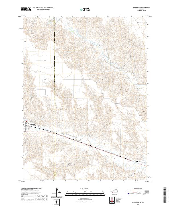
2021 Map of Wauneta East
USGS Topo · Published 2021About this map
Wauneta anchors the southwestern corner of this survey, where residential streets like E Cheyenne St and W Atoka St meet the rural road network. The landscape is defined by a network of drainage features cutting through the High Plains, including the deeply etched Horse Canyon, Trail Canyon, and Sand Canyon. These landforms funnel toward the Frenchman Cr valley, while further north, the Stinking Water Cr meanders across the border between Chase and Hayes Counties. In the northwestern reaches, Moody Reservoir provides a critical water source in an otherwise semi-arid environment dominated by section-line roads such as 348 Ave and 735 Rd. The transition from the structured grid of the town to the complex topography of the canyons illustrates the intersection of human planning and the natural breaks of the Nebraska Panhandle region.
Find a feature on this map
31 named features on this map. Tap any name to fly to it.
Don’t see what you’re looking for? This feature index may not catch every label — zoom into the map to look around manually.
Map Details
Editions of this 2021 Wauneta East Map
This is the sole edition of this map. No revisions or reprints were ever made.
Other maps of this area

1954 · McCook
USGS Topo · 1:250,000

1957 · McCook
USGS Topo · 1:250,000

1958 · McCook
USGS Topo · 1:250,000

1973 · Wauneta SW
USGS Topo · 1:24,000

1973 · Palisade SW
USGS Topo · 1:24,000

1973 · Wauneta SE
USGS Topo · 1:24,000

1974 · Hamlet
USGS Topo · 1:24,000

1974 · Dittons Creek SE
USGS Topo · 1:24,000
1974 · Wauneta West
USGS Topo · 1:24,000
1974 · Dittons Creek
USGS Topo · 1:24,000