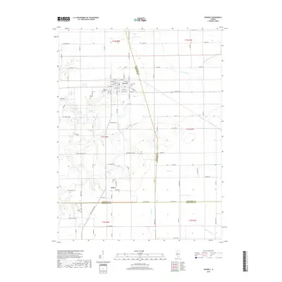
2018 Map of Waverly
USGS Topo · Published 2018About this map
Waverly and its surrounding countryside represent a classic Illinois agrarian landscape at the junction of Morgan, Sangamon, and Macoupin Counties. This 2018 survey detail provides an essential resource for genealogists, as the township is dotted with family and parish burying grounds, including Saint Sebastian Cem, Allis Cem, and Rogers Cem. The village itself is shown with a clear street grid featuring W State St and W Temple St, while the outskirts are defined by the winding course of Apple Cr and the larger basin of Waverly Lake. Further south, the map documents the smaller settlement of Rohrer, situated along the drainage of Sugar Cr. The intersection of county lines and the preservation of historic cemetery names like Pulliam Cem make this a vital record of the region's human and natural boundaries.
Find a feature on this map
98 named features on this map. Tap any name to fly to it.
Don’t see what you’re looking for? This feature index may not catch every label — zoom into the map to look around manually.
Map Details
Editions of this 2018 Waverly Map
This is the sole edition of this map. No revisions or reprints were ever made.
Other maps of this area

1923 · Carlinville
USGS Topo · 1:48,000

1924 · Waverly
USGS Topo · 1:62,500

1925 · Carlinville
USGS Topo · 1:62,500

1926 · Waverly
USGS Topo · 1:62,500

1931 · Carlinville
USGS Topo · 1:62,500

1932 · Greenfield
USGS Topo · 1:62,500

1932 · Jacksonville
USGS Topo · 1:62,500

1937 · Jacksonville
USGS Topo · 1:62,500

1948 · Quincy
USGS Topo · 1:250,000

1956 · Quincy
USGS Topo · 1:250,000