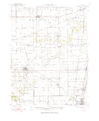
1924 Map of Waverly
USGS Topo · Published 1924About this map
Waverly and its surrounding prairie townships are defined by a dense network of early 20th-century rural infrastructure, where nearly every square mile is served by a named country school or church. The landscape is structured by several major rail lines, including the Wabash, Chicago And Northwestern, and the electric Illinois Traction line passing through Virden. Notable for its uniquely named local landmarks, the area features educational sites such as Highwater Mark School, Hong Kong School, and Mound Seminary School, which suggest a well-organized agrarian community. Small settlements like Lowder, Thayer, and Rohrer act as nodes along the tracks, while natural drainage follows the paths of Lick Creek and Apple Creek. The presence of the White Pilgrim School and McClain Church provides specific points of interest for genealogical research, documenting the social centers of these central Illinois townships before mid-century consolidation.
Find a feature on this map
90 named features on this map. Tap any name to fly to it.
Don’t see what you’re looking for? This feature index may not catch every label — zoom into the map to look around manually.
Map Details
Editions of this 1924 Waverly Map
2 editions found
Other maps of this area

1907 · Springfield
USGS Topo · 1:62,500

1909 · Tallula
USGS Topo · 1:62,500

1922 · Divernon
USGS Topo · 1:62,500

1923 · Carlinville
USGS Topo · 1:48,000

1923 · Raymond
USGS Topo · 1:62,500

1924 · Divernon
USGS Topo · 1:62,500

1924 · Waverly
USGS Topo · 1:62,500

1925 · Carlinville
USGS Topo · 1:62,500

1925 · Raymond
USGS Topo · 1:62,500

1926 · Waverly
USGS Topo · 1:62,500