
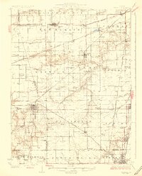
1926 Map of Waverly
USGS Topo · Published 1926About this map
The town of Waverly serves as a central hub in this mid-1920s portrait of central Illinois, where a complex network of rail lines and country roads connects small farming communities across Morgan and Sangamon counties. The landscape is defined by the headwaters of Lick Creek and Apple Creek, while the Illinois Traction System electric interurban line runs parallel to traditional rail carriers like the Chicago and Alton Railroad through Auburn and Virden.
Find a feature on this map
87 named features on this map. Tap any name to fly to it.
Don’t see what you’re looking for? This feature index may not catch every label — zoom into the map to look around manually.
Map Details
Editions of this 1926 Waverly Map
2 editions found
Other maps of this area

1907 · Springfield
USGS Topo · 1:62,500

1909 · Tallula
USGS Topo · 1:62,500

1922 · Divernon
USGS Topo · 1:62,500

1923 · Carlinville
USGS Topo · 1:48,000

1923 · Raymond
USGS Topo · 1:62,500

1924 · Divernon
USGS Topo · 1:62,500

1924 · Waverly
USGS Topo · 1:62,500

1925 · Carlinville
USGS Topo · 1:62,500

1925 · Raymond
USGS Topo · 1:62,500

1930 · Springfield
USGS Topo · 1:62,500