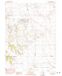
1983 Map of Waverly
USGS Topo · Published 1983About this map
Waverly serves as the central hub of this agricultural landscape in the early 1980s, where the Burlington Northern railroad bisects the town's grid. The area is notable for its numerous burial grounds, including St Sebastians Cem, East Cem, and Allis Cem, providing significant points of interest for genealogical research. To the south, the smaller settlement of Rohrer sits near the headwaters of Apple Creek, marking a shift toward more dissected terrain.
Find a feature on this map
31 named features on this map. Tap any name to fly to it.
Don’t see what you’re looking for? This feature index may not catch every label — zoom into the map to look around manually.
Map Details
Editions of this 1983 Waverly Map
This is the sole edition of this map. No revisions or reprints were ever made.
Other maps of this area

1923 · Carlinville
USGS Topo · 1:48,000

1924 · Waverly
USGS Topo · 1:62,500

1925 · Carlinville
USGS Topo · 1:62,500

1926 · Waverly
USGS Topo · 1:62,500

1931 · Carlinville
USGS Topo · 1:62,500

1932 · Greenfield
USGS Topo · 1:62,500

1932 · Jacksonville
USGS Topo · 1:62,500

1937 · Jacksonville
USGS Topo · 1:62,500

1948 · Quincy
USGS Topo · 1:250,000

1956 · Quincy
USGS Topo · 1:250,000