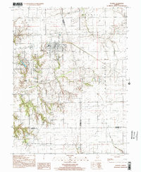
1998 Map of Waverly
USGS Topo · Published 2002About this map
Waverly serves as the central hub of this West Central Illinois landscape, where established street grids meet the industrial infrastructure of the late 20th century. The area is notable for its extensive Underground Gas Storage Field south of Waverly Lake, a significant utility feature marked by several pipelines and a Gas Pump Sta. For those tracing family histories in Morgan and Macoupin counties, the map preserves the exact locations of numerous smaller burial grounds including Allis Cem, Turner Cem, and St Sebastian's Cem. Outside the main town, the smaller settlement of Rohrer sits near the crossing of Apple Creek, while the surrounding townships of Maxwell, Talkington, and North Palmyra illustrate the enduring section-line road patterns and agricultural drainage into the South Fork and Otter Creek.
Find a feature on this map
29 named features on this map. Tap any name to fly to it.
Don’t see what you’re looking for? This feature index may not catch every label — zoom into the map to look around manually.
Map Details
Editions of this 1998 Waverly Map
This is the sole edition of this map. No revisions or reprints were ever made.
Other maps of this area

1923 · Carlinville
USGS Topo · 1:48,000

1924 · Waverly
USGS Topo · 1:62,500

1925 · Carlinville
USGS Topo · 1:62,500

1926 · Waverly
USGS Topo · 1:62,500

1931 · Carlinville
USGS Topo · 1:62,500

1932 · Greenfield
USGS Topo · 1:62,500

1932 · Jacksonville
USGS Topo · 1:62,500

1937 · Jacksonville
USGS Topo · 1:62,500

1948 · Quincy
USGS Topo · 1:250,000

1956 · Quincy
USGS Topo · 1:250,000