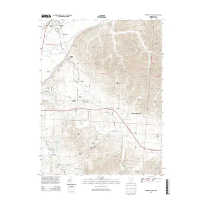
2013 Map of Waverly South
USGS Topo · Published 2013About this map
The Scioto River bends sharply through the northern reaches of this Pike County landscape, framing the southern limits of Waverly City and the neighboring community of Glen Jean. This 2013 survey illustrates a region defined by its narrow valleys and persistent family-named hollows, such as Bandy Hollow and Jenkins Hollow, which cut through the high ground east of the river. The southern portion of the map is dominated by the sprawling infrastructure surrounding Shyville and the Atomic Energy Commission Lake, a significant industrial footprint near the Little Beaver Cr. Local history is deeply etched into the terrain through numerous rural burial grounds, including the Evergreen Cem and Downing Cem. Settlements like Piketon and Zahns Corners serve as hubs along the local road network, connecting the river bottomlands to the wooded rises of Pine Knob and Sand Hill.
Find a feature on this map
149 named features on this map. Tap any name to fly to it.
Don’t see what you’re looking for? This feature index may not catch every label — zoom into the map to look around manually.
Map Details
Editions of this 2013 Waverly South Map
This is the sole edition of this map. No revisions or reprints were ever made.
Other maps of this area

1906 · Waverly
USGS Topo · 1:62,500

1908 · Waverly
USGS Topo · 1:62,500

1911 · Sciotoville
USGS Topo · 1:62,500

1913 · Sciotoville
USGS Topo · 1:62,500

1915 · Otway
USGS Topo · 1:62,500

1915 · Piketon
USGS Topo · 1:62,500

1917 · Piketon
USGS Topo · 1:62,500

1917 · Otway
USGS Topo · 1:62,500

1944 · Piketon
USGS Topo · 1:62,500

1947 · Columbus
USGS Topo · 1:250,000