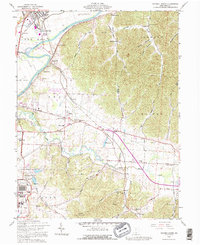
1992 Map of Waverly South
USGS Topo · Published 1995About this map
The Scioto River dominates the western corridor of this Pike County landscape, carving a wide valley that serves as the primary artery for both transit and industry. To the south, the massive industrial footprint of the Portsmouth Nuclear Power Plant stands in stark contrast to the surrounding rural townships of Seal and Union. This 1992 revision, based on earlier 1960s photogrammetry, captures the region's complex mix of atomic-age infrastructure and deep-rooted Appalachian settlements.
Find a feature on this map
70 named features on this map. Tap any name to fly to it.
Don’t see what you’re looking for? This feature index may not catch every label — zoom into the map to look around manually.
Map Details
Editions of this 1992 Waverly South Map
This is the sole edition of this map. No revisions or reprints were ever made.
Other maps of this area

1906 · Waverly
USGS Topo · 1:62,500

1908 · Waverly
USGS Topo · 1:62,500

1911 · Sciotoville
USGS Topo · 1:62,500

1913 · Sciotoville
USGS Topo · 1:62,500

1915 · Otway
USGS Topo · 1:62,500

1915 · Piketon
USGS Topo · 1:62,500

1917 · Piketon
USGS Topo · 1:62,500

1917 · Otway
USGS Topo · 1:62,500

1944 · Piketon
USGS Topo · 1:62,500

1947 · Columbus
USGS Topo · 1:250,000