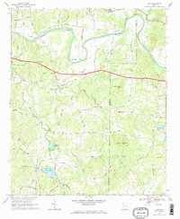
1968 Map of Wax
USGS Topo · Published 1969About this map
The Etowah River carves a winding path across this portion of North Georgia, creating the prominent Reynolds Bend before crossing the Floyd Co Bartow Co line. In the late 1960s, this rural landscape was defined by a dense network of country roads like Taylorsville Road and Chulio Road that connected small communities and homesteads. The map reveals a high concentration of community centers and family landmarks, including Woodlawn Ch, Bethel Ch, and the settlement of Wax.
Find a feature on this map
51 named features on this map. Tap any name to fly to it.
Don’t see what you’re looking for? This feature index may not catch every label — zoom into the map to look around manually.
Map Details
Editions of this 1968 Wax Map
3 editions found
Other maps of this area

1886 · Rome
USGS Topo · 1:125,000

1890 · Cartersville
USGS Topo · 1:125,000

1891 · Cartersville
USGS Topo · 1:125,000

1896 · Cartersville
USGS Topo · 1:125,000

1898 · Rome
USGS Topo · 1:125,000

1899 · Rome
USGS Topo · 1:125,000

1904 · Rome
USGS Topo · 1:125,000

1906 · Stilesboro
USGS Topo · 1:62,500

1908 · Stilesboro
USGS Topo · 1:62,500

1941 · Adairsville
USGS Topo · 1:62,500