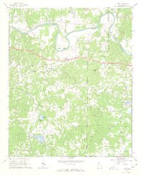
1968 Map of Wax
USGS Topo · Published 1969About this map
The Etowah River carves a sweeping path through the northern half of this 1968 landscape, defining the topography around Reynolds Bend and the Southern Railway corridor. Located along the border of Floyd and Bartow counties, the area is characterized by a dense network of rural landmarks, particularly in the vicinity of Wax. Numerous small churches and burial grounds, such as Bethel Ch and Gore Spring Ch Cem, suggest a deeply rooted community structure during the late 1960s. Terrain features like Yellow Jacket Mtn and Mullinax Mtn rise above the river valley, while man-made infrastructure like a Lookout Tower and Radio Tower indicate the era's utility and fire-monitoring systems. The presence of a Gravel Pit near the river reflects local extraction efforts amidst a landscape largely focused on agriculture and small-scale settlement.
Find a feature on this map
43 named features on this map. Tap any name to fly to it.
Don’t see what you’re looking for? This feature index may not catch every label — zoom into the map to look around manually.
Map Details
Editions of this 1968 Wax Map
3 editions found
Other maps of this area

1886 · Rome
USGS Topo · 1:125,000

1890 · Cartersville
USGS Topo · 1:125,000

1891 · Cartersville
USGS Topo · 1:125,000

1896 · Cartersville
USGS Topo · 1:125,000

1898 · Rome
USGS Topo · 1:125,000

1899 · Rome
USGS Topo · 1:125,000

1904 · Rome
USGS Topo · 1:125,000

1906 · Stilesboro
USGS Topo · 1:62,500

1908 · Stilesboro
USGS Topo · 1:62,500

1941 · Adairsville
USGS Topo · 1:62,500