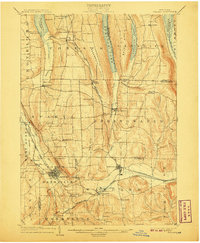
1904 Map of Wayland
USGS Topo · Published 1907About this map
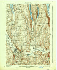
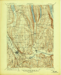
The Finger Lakes region of Western New York is defined here by the distinct parallel waters of Conesus Lake, Hemlock Lake, Canadice Lake, and Honeoye Lake. This early 20th-century landscape is a network of ridge-top farms and valley-bottom industrial centers, particularly around the concentrated hubs of Dansville and Wayland. The terrain, marked by steep glens and deep cuts like Stony Brook Glen and Pokamoonshine Gulf, dictated the winding paths of several competing railroads including the Erie R. R. and the Delaware Lackawanna and Western R. R..
Find a feature on this map
63 named features on this map. Tap any name to fly to it.
Don’t see what you’re looking for? This feature index may not catch every label — zoom into the map to look around manually.
Map Details
Editions of this 1904 Wayland Map
7 editions found
Other maps of this area

1900 · Naples
USGS Topo · 1:62,500

1900 · Canandaigua
USGS Topo · 1:62,500

1901 · Honeoye
USGS Topo · 1:62,500

1902 · Wayland
USGS Topo · 1:62,500

1903 · Naples
USGS Topo · 1:62,500

1903 · Canandaigua
USGS Topo · 1:62,500

1904 · Wayland
USGS Topo · 1:62,500

1904 · Caledonia
USGS Topo · 1:62,500

1904 · Honeoye
USGS Topo · 1:62,500

1905 · Nunda
USGS Topo · 1:62,500