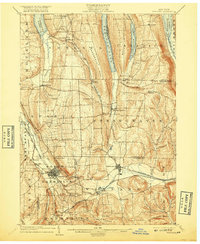
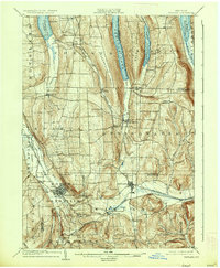
1904 Map of Wayland
USGS Topo · Published 1917About this map
Dansville and Wayland anchor this early twentieth-century survey of the Finger Lakes region, where the industrial and agricultural landscape is defined by the heavy presence of major railroads. The Erie R.R. (Rochester Div.), the Delaware Lackawanna and Western R.R., and the Pittsburgh Shawmut and Northern R.R. converge in the southern valleys, providing essential transit for local commerce like the Stones Falls Mill.
Find a feature on this map
60 named features on this map. Tap any name to fly to it.
Don’t see what you’re looking for? This feature index may not catch every label — zoom into the map to look around manually.
Map Details
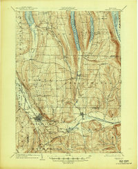
Editions of this 1904 Wayland Map
7 editions found
Other maps of this area

1900 · Naples
USGS Topo · 1:62,500

1900 · Canandaigua
USGS Topo · 1:62,500

1901 · Honeoye
USGS Topo · 1:62,500

1902 · Wayland
USGS Topo · 1:62,500

1903 · Naples
USGS Topo · 1:62,500

1903 · Canandaigua
USGS Topo · 1:62,500

1904 · Wayland
USGS Topo · 1:62,500

1904 · Caledonia
USGS Topo · 1:62,500

1904 · Honeoye
USGS Topo · 1:62,500

1905 · Nunda
USGS Topo · 1:62,500