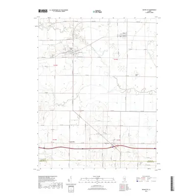
2018 Map of Wayne City
USGS Topo · Published 2018About this map
Wayne City stands as the primary hub in this southern Illinois landscape, situated at the intersection of several local routes such as Co RD 600e and Co RD 600 N. The village is surrounded by a network of waterways, most notably the meandering Skillet Fork, which flows past Fleming Ridge and feeds into the Skillet Fork Lagoon. To the north, the small community of Sims is defined by a grid including N Railroad St and S Railroad St, indicating the historical significance of the rail corridor through the area.
Find a feature on this map
76 named features on this map. Tap any name to fly to it.
Don’t see what you’re looking for? This feature index may not catch every label — zoom into the map to look around manually.
Map Details
Editions of this 2018 Wayne City Map
This is the sole edition of this map. No revisions or reprints were ever made.
Other maps of this area

1941 · Enfield
USGS Topo · 1:62,500

1942 · McLeansboro
USGS Topo · 1:62,500

1944 · Enfield
USGS Topo · 1:62,500

1945 · McLeansboro
USGS Topo · 1:62,500

1947 · Wayne City
USGS Topo · 1:62,500

1948 · Fairfield
USGS Topo · 1:62,500

1958 · Belleville
USGS Topo · 1:250,000

1962 · Belleville
USGS Topo · 1:250,000
1970 · Geff
USGS Topo · 1:24,000
1971 · Boyleston
USGS Topo · 1:24,000