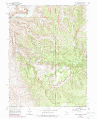
1968 Map of Weaver Ridge
USGS Topo · Published 1987About this map
The White River carves through the northern reach of this high-desert landscape on the border of Utah and Colorado. Energy development and extraction define the area's mid-century character, evidenced by the presence of a Gas Well, multiple Drill Holes, and scattered Prospects throughout the rugged drainage basins. Industrial infrastructure is etched into the terrain, including a long Pipeline and a remote Landing Strip situated near the intersection of the Uintah and Rio Blanco county line.
Find a feature on this map
18 named features on this map. Tap any name to fly to it.
Don’t see what you’re looking for? This feature index may not catch every label — zoom into the map to look around manually.
Map Details
Editions of this 1968 Weaver Ridge Map
2 editions found
Other maps of this area

1885 · East Tavaputs
USGS Topo · 1:250,000

1885 · Ashley
USGS Topo · 1:250,000

1907 · Rangely
USGS Topo · 1:125,000

1907 · Jensen
USGS Topo · 1:125,000

1910 · Jensen
USGS Topo · 1:125,000

1910 · Rangely
USGS Topo · 1:125,000

1954 · Vernal
USGS Topo · 1:250,000

1956 · Grand Junction
USGS Topo · 1:250,000

1958 · Vernal
USGS Topo · 1:250,000

1959 · Grand Junction
USGS Topo · 1:250,000