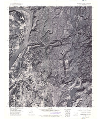
1974 Map of Webbers Falls NW
USGS Topo · Published 1974About this map
Camp Gruber (Abandoned) dominates the central landscape of this 1970s orthophotoquad, showing the intricate grid of the former military installation north of Braggs. The aerial imagery reveals the stark contrast between the structured footprints of the military facility and the surrounding winding terrain of Muskogee County. Along the western edge, the wide expanse of the Webbers Falls Reservoir cuts through the territory, while Greenleaf Lake anchors the southeastern corner. This photographic record provides a rare look at the physical state of the abandoned camp and the small settlement of Braggs during a period when the natural vegetation was reclaiming the decommissioned areas of the base.
Find a feature on this map
4 named features on this map. Tap any name to fly to it.
Don’t see what you’re looking for? This feature index may not catch every label — zoom into the map to look around manually.
Map Details
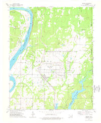
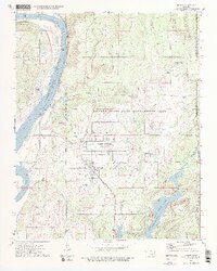
Editions of this 1974 Webbers Falls NW Map
3 editions found
Other maps of this area

1901 · Muscogee
USGS Topo · 1:125,000

1905 · Muscogee
USGS Topo · 1:125,000

1946 · Fort Smith
USGS Topo · 1:250,000

1948 · Hulbert
USGS Topo · 1:62,500

1948 · Keefeton
USGS Topo · 1:62,500

1948 · Webbers Falls
USGS Topo · 1:62,500

1948 · Wagoner
USGS Topo · 1:62,500

1950 · Keefeton
USGS Topo · 1:62,500

1950 · Wagoner
USGS Topo · 1:62,500

1950 · Hulbert
USGS Topo · 1:62,500