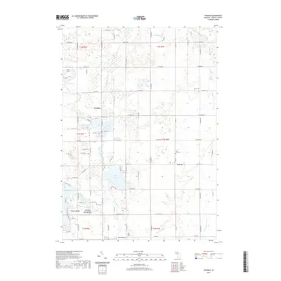
2019 Map of Weidman
USGS Topo · Published 2019About this map
Coldwater River and the Chippewa River define the hydrological character of this Isabella County landscape, where the waters are managed across several reservoirs and lakes. The central settlement of Weidman sits near Perch Lake, while the expansive Lake Isabella serves as a major residential and recreational anchor in the southwest. Local history is deeply etched into the township through its numerous burial grounds, including Saint Joseph Cem near Beal City and Fairview Cem west of the river. Aviation infrastructure is surprisingly prominent for a rural area, with both the Ojibwa Airpark and the Lake Isabella - Cal Brewer Memorial Airport serving the region. To the south, the small community of Two Rivers marks the confluence near where Hogg Cr joins the larger system, illustrating the enduring relationship between Michigan's inland settlements and its river networks.
Find a feature on this map
57 named features on this map. Tap any name to fly to it.
Don’t see what you’re looking for? This feature index may not catch every label — zoom into the map to look around manually.
Map Details
Editions of this 2019 Weidman Map
This is the sole edition of this map. No revisions or reprints were ever made.
Other maps of this area

1916 · Mount Pleasant
USGS Topo · 1:62,500

1919 · Mount Pleasant
USGS Topo · 1:62,500

1943 · Mount Pleasant
USGS Topo · 1:62,500

1954 · Midland
USGS Topo · 1:250,000

1958 · Midland
USGS Topo · 1:250,000

1959 · Midland
USGS Topo · 1:250,000

1959 · Lake
USGS Topo · 1:62,500

1959 · Clare
USGS Topo · 1:62,500

1964 · Blanchard
USGS Topo · 1:24,000

1964 · Sherman City
USGS Topo · 1:24,000