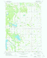
1973 Map of Weidman
USGS Topo · Published 1976About this map
Coldwater Lake and the Lake Isabella reservoir anchor this central Michigan landscape during a period of mid-century residential and recreational development. The village of Weidman serves as a local hub at the junction of the Coldwater River and Walker Creek, featuring Mitchell Park and the nearby Weidman Ch. To the southeast, the smaller community of Beal City is centered around a High Sch and St Joseph Cem.
Find a feature on this map
52 named features on this map. Tap any name to fly to it.
Don’t see what you’re looking for? This feature index may not catch every label — zoom into the map to look around manually.
Map Details
Editions of this 1973 Weidman Map
This is the sole edition of this map. No revisions or reprints were ever made.
Other maps of this area

1916 · Mount Pleasant
USGS Topo · 1:62,500

1919 · Mount Pleasant
USGS Topo · 1:62,500

1943 · Mount Pleasant
USGS Topo · 1:62,500

1954 · Midland
USGS Topo · 1:250,000

1958 · Midland
USGS Topo · 1:250,000

1959 · Midland
USGS Topo · 1:250,000

1959 · Lake
USGS Topo · 1:62,500

1959 · Clare
USGS Topo · 1:62,500

1964 · Blanchard
USGS Topo · 1:24,000

1964 · Sherman City
USGS Topo · 1:24,000