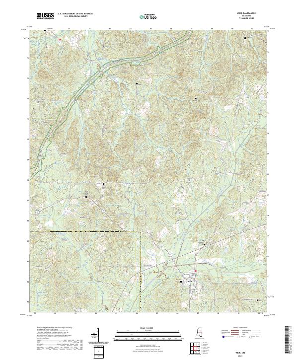
2024 Map of Weir
USGS Topo · Published 2024About this map
The Yockanookany River winds through the southern portion of this region, shaping the local geography near the town of Weir. This landscape is deeply connected to its community heritage, evidenced by a high density of rural burial grounds such as Mill Springs Cem, Mount Moriah Cem, and the Bethlehem Missionary Baptist Church Cem. The Natchez Trace Parkway cuts diagonally across the northwest, following the historic path through Choctaw and Attala counties. Away from the main river valley, the terrain is defined by numerous drainage systems including Besa Chitto Creek and McCurtain Creek. The smaller settlement of Penderville anchors the southeast corner, connected by a network of rural routes like Chester Mills Rd and Weir Salem Rd that link these isolated homesteads and family landmarks.
Find a feature on this map
83 named features on this map. Tap any name to fly to it.
Don’t see what you’re looking for? This feature index may not catch every label — zoom into the map to look around manually.
Map Details
Editions of this 2024 Weir Map
This is the sole edition of this map. No revisions or reprints were ever made.
Other maps of this area

1953 · West Point
USGS Topo · 1:250,000

1958 · West Point
USGS Topo · 1:250,000

1963 · West Point
USGS Topo · 1:250,000

1966 · Stewart
USGS Topo · 1:24,000

1966 · Weir
USGS Topo · 1:24,000

1966 · Tomnolen
USGS Topo · 1:24,000

1966 · French Camp
USGS Topo · 1:24,000

1968 · Weir
USGS Topo · 1:62,500

1972 · McCool
USGS Topo · 1:24,000

1972 · Highpoint
USGS Topo · 1:24,000