
1958 Map of Wekiwa
USGS Topo · Published 1959About this map
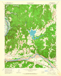
The Arkansas River carves a deep valley through the heart of the Osage Indian Reservation on this mid-century survey. The landscape is defined by the heavy presence of energy production, with numerous Oil Wells and a Gas Well scattered across the uplands of Black Dog and the Redfork Field. Transportation is anchored by the St Louis San Francisco and Missouri Kansas Texas railroads, which parallel the river through the fertile Fisher Bottom. Local community life in the late 1950s centered around rural institutions like the Anderson Sch and Tanglewood Ch, while aviation is represented by Simms Landing Field near the Spillway 725 of Shell Lake. Note the dashed blue patterns indicating areas destined for inundation by the future Keystone Reservoir.
Find a feature on this map
31 named features on this map. Tap any name to fly to it.
Don’t see what you’re looking for? This feature index may not catch every label — zoom into the map to look around manually.
Map Details
Editions of this 1958 Wekiwa Map
5 editions found
Other maps of this area

1912 · Hominy
USGS Topo · 1:125,000

1915 · Hominy
USGS Topo · 1:125,000

1915 · Hominy
USGS Topo · 1:62,500

1955 · Enid
USGS Topo · 1:250,000

1956 · Sand Springs
USGS Topo · 1:24,000

1956 · Sapulpa North
USGS Topo · 1:24,000

1958 · Enid
USGS Topo · 1:250,000

1958 · Keystone Dam
USGS Topo · 1:24,000
1958 · Mannford SE
USGS Topo · 1:24,000
1959 · Lake Sahoma
USGS Topo · 1:24,000