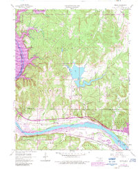
1958 Map of Wekiwa
USGS Topo · Published 1983About this map
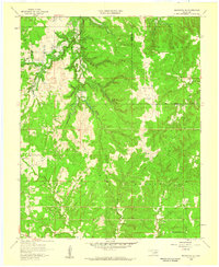
The Arkansas River flows through the southern half of this landscape, separating the flat agricultural Fisher Bottom and Red Fork regions from the northern hills of Black Dog. This 1958 survey, updated with 1983 revisions, illustrates a transition from rural Oklahoma townships to the expanding outskirts of the Tulsa Metropolitan Area. The arrival of major water management is evident in the northwestern corner where Keystone Lake inundates former riverbanks, while interior reservoirs like Shell Lake and Phillips Lake are surrounded by clusters of oil wells and several quarries. Small communities and institutional markers like Wekiwa, Lotsee, and the Tanglewood Sch dot the terrain alongside more modern developments such as the William R Pogue Municipal Airport and Eagles Nest Airfield. This era shows the heavy presence of energy infrastructure, with numerous pipelines and wells crisscrossing the Osage Indian Reservation Boundary and the Wekiwa Twp countryside.
Find a feature on this map
36 named features on this map. Tap any name to fly to it.
Don’t see what you’re looking for? This feature index may not catch every label — zoom into the map to look around manually.
Map Details
Editions of this 1958 Wekiwa Map
5 editions found
Other maps of this area

1912 · Hominy
USGS Topo · 1:125,000

1915 · Hominy
USGS Topo · 1:125,000

1915 · Hominy
USGS Topo · 1:62,500

1955 · Enid
USGS Topo · 1:250,000

1956 · Sand Springs
USGS Topo · 1:24,000

1956 · Sapulpa North
USGS Topo · 1:24,000

1958 · Enid
USGS Topo · 1:250,000

1958 · Keystone Dam
USGS Topo · 1:24,000
1958 · Mannford SE
USGS Topo · 1:24,000

1958 · Wekiwa
USGS Topo · 1:24,000