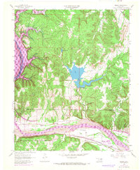
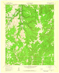
1958 Map of Wekiwa
USGS Topo · Published 1969About this map
The Osage Indian Reservation Boundary cuts through this river-valley landscape where the Arkansas River serves as a dominant geographic and economic artery. Small settlements like Wekiwa sit at the intersection of the river and the St Louis - San Francisco railroad line, reflecting the vital transport networks of mid-century Oklahoma. This 1958 survey, updated with 1967 aerial photography, captures the terrain as the Keystone Reservoir began to influence the regional hydrology, noted in the margin's inundation data.
Find a feature on this map
17 named features on this map. Tap any name to fly to it.
Don’t see what you’re looking for? This feature index may not catch every label — zoom into the map to look around manually.
Map Details
Editions of this 1958 Wekiwa Map
5 editions found
Other maps of this area

1912 · Hominy
USGS Topo · 1:125,000

1915 · Hominy
USGS Topo · 1:125,000

1915 · Hominy
USGS Topo · 1:62,500

1955 · Enid
USGS Topo · 1:250,000

1956 · Sand Springs
USGS Topo · 1:24,000

1956 · Sapulpa North
USGS Topo · 1:24,000

1958 · Enid
USGS Topo · 1:250,000

1958 · Keystone Dam
USGS Topo · 1:24,000
1958 · Mannford SE
USGS Topo · 1:24,000

1958 · Wekiwa
USGS Topo · 1:24,000