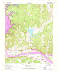
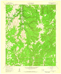
1958 Map of Wekiwa
USGS Topo · Published 1976About this map
The confluence of the Cimarron River and the Arkansas River defines this landscape during a period of transition, as the rising waters of Keystone Lake began to reshape the valley. The map documents the intricate overlap of the Osage Indian Reservation Boundary with the growing industrial footprint of the Red Fork Oil Field, characterized by a dense network of oil and gas wells. Local life is anchored by rural institutions like Fisher Ch and Anderson Sch, while the presence of the St Louis San Francisco railroad and the Old Railroad Grade illustrate the region's evolving transportation corridors. From the broad Fisher Bottom to the upland reaches of Black Dog, the map captures the essential character of this riverine territory just as major reservoir projects were altering the terrain.
Find a feature on this map
36 named features on this map. Tap any name to fly to it.
Don’t see what you’re looking for? This feature index may not catch every label — zoom into the map to look around manually.
Map Details
Editions of this 1958 Wekiwa Map
5 editions found
Other maps of this area

1912 · Hominy
USGS Topo · 1:125,000

1915 · Hominy
USGS Topo · 1:125,000

1915 · Hominy
USGS Topo · 1:62,500

1955 · Enid
USGS Topo · 1:250,000

1956 · Sand Springs
USGS Topo · 1:24,000

1956 · Sapulpa North
USGS Topo · 1:24,000

1958 · Enid
USGS Topo · 1:250,000

1958 · Keystone Dam
USGS Topo · 1:24,000
1958 · Mannford SE
USGS Topo · 1:24,000

1958 · Wekiwa
USGS Topo · 1:24,000