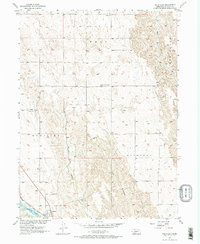
1956 Map of Wellfleet
USGS Topo · Published 1974About this map
The settlement of Wellfleet serves as the focal point for this mid-century topographic survey of south-central Lincoln County. The landscape is defined by the deep incisions of Well Canyon, Hay Canyon, and Lake Canyon, which draw toward the Burlington and Quincy railroad line and the waters of Wellfleet Lake. This rail corridor was the lifeblood of the local economy during this era, connecting the isolated prairie townships of Well, Medicine, and Buchanan. Rural social infrastructure is remarkably well-documented here, including the Echo Sch, Community Center Sch, and the landmark known as Latimer. For genealogists, the map provides precise locations for the Wellfleet Cem and the Lutheran Cem, offering a spatial record of the community's early 20th-century footprint before modern agricultural shifts altered the local landscape.
Find a feature on this map
16 named features on this map. Tap any name to fly to it.
Don’t see what you’re looking for? This feature index may not catch every label — zoom into the map to look around manually.
Map Details
Editions of this 1956 Wellfleet Map
3 editions found
Other maps of this area

1954 · McCook
USGS Topo · 1:250,000

1956 · Wellfleet NW
USGS Topo · 1:24,000

1956 · White NE
USGS Topo · 1:24,000

1956 · Curtis NW
USGS Topo · 1:24,000

1956 · Curtis
USGS Topo · 1:24,000

1956 · Somerset
USGS Topo · 1:24,000

1956 · Wellfleet SE
USGS Topo · 1:24,000

1956 · Wellfleet
USGS Topo · 1:24,000

1956 · Wellfleet NE
USGS Topo · 1:24,000

1957 · McCook
USGS Topo · 1:250,000