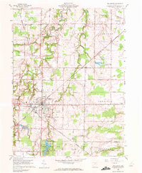
1960 Map of Wellington
USGS Topo · Published 1972About this map
The village of Wellington serves as the central hub of this 1960 topographic study, situated at the convergence of the New York Central Railroad and the New York Chicago and St Louis Railroad. This rail infrastructure highlights the area's significance as a transportation and logistics node for southern Lorain County during the mid-century. The map captures a landscape defined by organized agricultural townships like Pittsfield and Penfield, where farm-to-market roads such as Whitney Road and Wadsworth Road grid the terrain.
Find a feature on this map
43 named features on this map. Tap any name to fly to it.
Don’t see what you’re looking for? This feature index may not catch every label — zoom into the map to look around manually.
Map Details
Editions of this 1960 Wellington Map
3 editions found
Other maps of this area

1901 · Oberlin
USGS Topo · 1:62,500

1903 · Vermilion
USGS Topo · 1:62,500

1903 · Oberlin
USGS Topo · 1:62,500

1904 · Wellington
USGS Topo · 1:62,500

1906 · Wellington
USGS Topo · 1:62,500

1908 · New London
USGS Topo · 1:62,500

1953 · Grafton
USGS Topo · 1:24,000

1956 · Toledo
USGS Topo · 1:250,000

1959 · Kipton
USGS Topo · 1:24,000

1960 · Oberlin
USGS Topo · 1:24,000