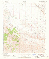
1954 Map of Wells Ranch
USGS Topo · Published 1967About this map
The Carrizo Plain and the sharp linear feature of the Elkhorn Scarp dominate the topography of this San Luis Obispo County survey. Ranching infrastructure is central to the landscape, with the Kern County Land Co Ranch, Seaback Ranch, and Wells Ranch serving as primary hubs for livestock operations. This era of land use is defined by scattered Grain Tanks and Water Tanks that sustained agricultural efforts in a region where water sources like Wells Spring and Semper Spr were vital. To the southwest, the Caliente Range rises abruptly, dissected by numerous deep drainages including Abbott Canyon and Sulphur Canyon. A notable historical landmark, The Old Adobe, sits north of the mountains, suggesting earlier settlement patterns before the mid-century ranching layout was established. The map meticulously records the township and range lines that gridded this remote territory during the mid-1950s.
Find a feature on this map
27 named features on this map. Tap any name to fly to it.
Don’t see what you’re looking for? This feature index may not catch every label — zoom into the map to look around manually.
Map Details
Editions of this 1954 Wells Ranch Map
3 editions found
Other maps of this area

1902 · Santa Ynez
USGS Topo · 1:125,000

1905 · Santa Ynez
USGS Topo · 1:125,000

1912 · McKittrick
USGS Topo · 1:125,000

1941 · Caliente Mountain
USGS Topo · 1:62,500

1941 · McPherson Peak
USGS Topo · 1:62,500

1942 · Caliente Mtn
USGS Topo · 1:62,500

1942 · East of Cuyama Ranch
USGS Topo · 1:24,000

1943 · McPherson Peak
USGS Topo · 1:62,500

1943 · Caliente Mtn.
USGS Topo · 1:62,500

1943 · Cuyama Ranch
USGS Topo · 1:31,680