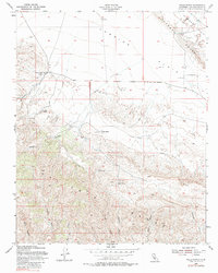
1954 Map of Wells Ranch
USGS Topo · Published 1980About this map
Agricultural life in the mid-1950s California high desert is centered on remote outposts like the Kern County Land Co Ranch and Wells Ranch. This landscape is defined by the sharp transition from the flat, dry expanses of the Carrizo Plain and Elkhorn Plain into the complex drainages of the Caliente Range. Ranching infrastructure is prominent, with several Grain Tanks and isolated Corrals scattered across the plains, while the presence of The Old Adobe suggests an older layer of habitation in this arid environment.
Find a feature on this map
25 named features on this map. Tap any name to fly to it.
Don’t see what you’re looking for? This feature index may not catch every label — zoom into the map to look around manually.
Map Details
Editions of this 1954 Wells Ranch Map
3 editions found
Other maps of this area

1902 · Santa Ynez
USGS Topo · 1:125,000

1905 · Santa Ynez
USGS Topo · 1:125,000

1912 · McKittrick
USGS Topo · 1:125,000

1941 · Caliente Mountain
USGS Topo · 1:62,500

1941 · McPherson Peak
USGS Topo · 1:62,500

1942 · Caliente Mtn
USGS Topo · 1:62,500

1942 · East of Cuyama Ranch
USGS Topo · 1:24,000

1943 · McPherson Peak
USGS Topo · 1:62,500

1943 · Caliente Mtn.
USGS Topo · 1:62,500

1943 · Cuyama Ranch
USGS Topo · 1:31,680