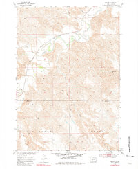
1953 Map of Wendte
USGS Topo · Published 1981About this map
The Bad River and its intricate drainage system define this mid-century landscape along the border of Stanley and Jones Counties. Surveyed as part of the Missouri River Basin development program, the map captures a rural environment focused on the small settlement of Wendte, situated where the Chicago and North Western railroad traverses the valley. The presence of the Matthew Sch suggests the locations of former rural school districts that once served the scattered homesteads of the Van Metre and Banner areas.
Find a feature on this map
17 named features on this map. Tap any name to fly to it.
Don’t see what you’re looking for? This feature index may not catch every label — zoom into the map to look around manually.
Map Details
Editions of this 1953 Wendte Map
3 editions found
Other maps of this area

1937 · Oahe
USGS Topo · 1:62,500

1951 · Van Metre
USGS Topo · 1:24,000

1951 · Capa SE
USGS Topo · 1:24,000

1953 · Teton
USGS Topo · 1:24,000

1953 · Oahe SW
USGS Topo · 1:24,000

1953 · Wendte
USGS Topo · 1:24,000

1953 · Wendte NE
USGS Topo · 1:24,000

1954 · Pierre
USGS Topo · 1:250,000

1958 · Pierre
USGS Topo · 1:250,000
1972 · Wendte SE
USGS Topo · 1:24,000