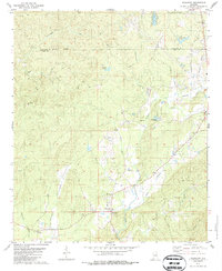
1979 Map of Weogufka
USGS Topo · Published 1987About this map
Weogufka and the surrounding Coosa County landscape are defined by a dense network of winding creeks and rural institutional landmarks in this late 1970s survey. The settlement of Unity sits near the southwestern corner, while the central hills are punctuated by numerous country churches, including Estelle Ch, Grimes Chapel, and the Church of God. The topography is heavily intersected by watercourses like Peckernwood Creek, Finikochika Creek, and the curiously named Breastworks Creek, suggesting a terrain where water management and local crossing points were vital to the community's movement.
Find a feature on this map
36 named features on this map. Tap any name to fly to it.
Don’t see what you’re looking for? This feature index may not catch every label — zoom into the map to look around manually.
Map Details
Editions of this 1979 Weogufka Map
2 editions found
Other maps of this area

1890 · Talladega
USGS Topo · 1:125,000

1892 · Talladega
USGS Topo · 1:125,000

1901 · Wetumpka
USGS Topo · 1:125,000

1903 · Wetumpka
USGS Topo · 1:125,000

1915 · Gantts Quarry
USGS Topo · 1:48,000

1917 · Gantts Quarry
USGS Topo · 1:62,500

1944 · Goodwater
USGS Topo · 1:62,500

1947 · Goodwater
USGS Topo · 1:62,500

1953 · Montgomery
USGS Topo · 1:250,000

1953 · Birmingham
USGS Topo · 1:250,000