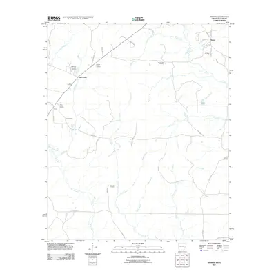
2011 Map of Wesson
USGS Topo · Published 2011About this map
Wesson and the settlement of Three Creeks anchor this southern Arkansas landscape, situated along the border with Louisiana. The area is defined by a dense network of burial grounds, providing a significant resource for genealogical research into the region's early families. Notable sites include Wesson Cemetery, Andrews Chapel Cemetery, Jones Cemetery, and Scotland Cemetery. The terrain is woven with minor waterways like Beech Creek, Sugar Creek, and Francis Creek, which feed into the larger system of Three Creeks. While residential density is light, the presence of numerous small cemetery sites such as Brown Cemetery and Masondia Cemetery suggests a deeply rooted community history that predates the modern road grid. Local landmarks like Cooks Pond and the Arkansas Noname 49 Dam reflect the local hydrology and small-scale water management in Union County.
Find a feature on this map
65 named features on this map. Tap any name to fly to it.
Don’t see what you’re looking for? This feature index may not catch every label — zoom into the map to look around manually.
Map Details
Editions of this 2011 Wesson Map
This is the sole edition of this map. No revisions or reprints were ever made.
Other maps of this area

1927 · El Dorado
USGS Topo · 1:62,500

1930 · El Dorado
USGS Topo · 1:62,500

1951 · Summerfield
USGS Topo · 1:62,500

1951 · Bernice
USGS Topo · 1:62,500

1951 · El Dorado
USGS Topo · 1:62,500

1953 · El Dorado
USGS Topo · 1:250,000

1955 · Shreveport
USGS Topo · 1:250,000

1956 · Shreveport
USGS Topo · 1:250,000

1957 · El Dorado
USGS Topo · 1:250,000

1958 · El Dorado
USGS Topo · 1:250,000