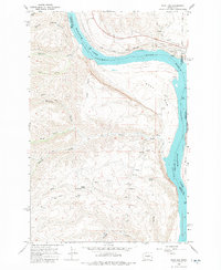
1966 Map of West Bar
USGS Topo · Published 1980About this map
The Great Northern railway skirts the high bluffs of the Wanapum Lake Columbia River in this mid-1960s survey of the Kittitas and Douglas County border. The settlement of Trinidad serves as a focal point near the northern bend of the river, where industrial activity is evidenced by a Gaging Station, Storage Bins, and several gravel pits. The landscape transitions from the broad alluvial surface of West Bar to the steep, dissected uplands of Cape Horn and Babcock Bench.
Find a feature on this map
36 named features on this map. Tap any name to fly to it.
Don’t see what you’re looking for? This feature index may not catch every label — zoom into the map to look around manually.
Map Details
Editions of this 1966 West Bar Map
2 editions found
Other maps of this area

1909 · Quincy
USGS Topo · 1:62,500

1910 · Quincy
USGS Topo · 1:62,500

1912 · Malaga
USGS Topo · 1:48,000

1914 · Malaga
USGS Topo · 1:62,500

1920 · Colockum Pass
USGS Topo · 1:125,000

1922 · Colockum Pass
USGS Topo · 1:125,000

1953 · Ritzville
USGS Topo · 1:250,000

1957 · Wenatchee
USGS Topo · 1:250,000

1959 · Ritzville
USGS Topo · 1:250,000

1965 · Ritzville
USGS Topo · 1:250,000